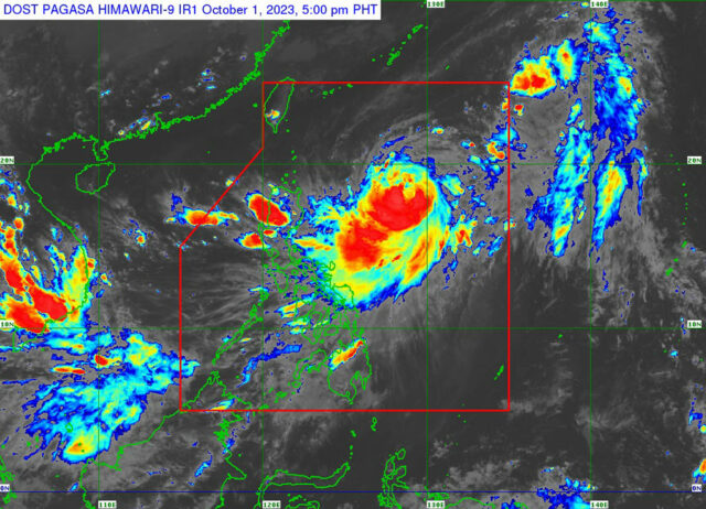
Koinu to become typhoon as it passes through Luzon

SEVERE tropical storm Koinu, locally named Jenny, is expected to intensify into a typhoon as it passes through northern Philippines, the state weather bureau said on Sunday.
In an 11 a.m. bulletin, the Philippine Atmospheric, Geophysical and Astronomical Services Administration (PAGASA) said the storm was seen 790 kilometers east of Tuguegarao City, Cagayan province.
It was moving northwestward at 15 kilometers per hour (kph) with maximum sustained winds of 95 kph near the center and gustiness of up to 115 kph.
“Jenny is forecast to steadily intensify throughout the forecast period and may reach typhoon category (on Monday),” PAGASA said. “This tropical cyclone could attain its peak intensity of 150 kph by Tuesday.”
The weather bureau said it could not rule out a landfall because the storm is expected to pass over Batanes and the southern portion of Taiwan on Wednesday.
It added that the storm would continue to enhance the Southwest Monsoon and bring occasional rains over the western portions of Central and Southern Luzon, the Visayas and Mindanao in the next three days.
Heavy rains are expected in Cagayan, Isabela, Quezon including Polillo Islands, Camarines Norte, Camarines Sur, Catanduanes, Albay, Sorsogon, Northern Samar and Eastern Samar.
PAGASA had not hoisted any typhoon wind signals.
“The current forecast scenario shows that tropical cyclone wind signals may be hoisted over extreme Northern Luzon… in anticipation of the onset of severe tropical cyclone winds,” it said.
Koinu is also expected to cause moderate to rough seas over the coastal waters of extreme northern Luzon and the northern part of Cagayan province.
“Mariners of motor bancas and similarly sized vessels are advised to take precautionary measures while venturing out to sea and, if possible, avoid navigating in these conditions, especially if inexperienced or operating ill-equipped vessels,” PAGASA said.
A gale warning might be issued in the coming days. — Adrian H. Halili


